


Khyber Optics
Autel Robotics EVO Max 4N
Autel Robotics EVO Max 4N
Couldn't load pickup availability
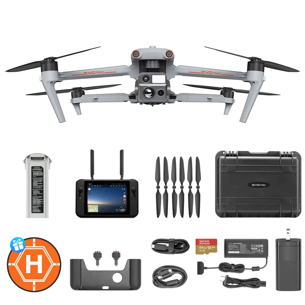
- One Complimentary Battery and Landing Pad
- Starlight Night-Vision Camera | as low as 0.0001 LUX and ISO ranges from 100-450,000
- Lock Targets & Track at Night
- Thermal Camera:640x512 | 16x Digital Zoom
- Wide Camera: 50MP | 1/1.28" CMOS
- Laser Rangefinder
- Autel SkyLink 3.0 | 12.4 miles Transmission Range
- 720° Obstacle Avoidance
- 42 mins Max Flight Time
- A-Mesh 1.0 | Mesh Networking Technology
- 3D Map Planning | Multiple Mission Types | Data Security
- Multi-channel Projection Screen*
- Autel SDK
Autel EVO Max 4N — Product Overview
The EVO Max 4N is an enterprise drone built for low-light inspection, public safety and emergency response. Its integrated starlight camera, thermal imaging, laser ranging and autonomous navigation provide situational awareness in challenging environments.
Autonomous Path Finding
Autel's autonomy engine uses environmental sensing to plan three-dimensional flight paths around structures and terrain.

GPS-Denied Navigation
Onboard sensing supports navigation in locations where satellite positioning is unreliable, including enclosed structures.
Object Recognition
AI-assisted recognition supports identifying and tracking people, vehicles and heat sources.

Flight Safety and Durability
Binocular vision and millimeter-wave radar support obstacle detection in low-light conditions. The IP43-rated platform is designed to resist limited dust ingress and spraying water. The listed operating temperature range is −4°F to 122°F.
Flight Performance
A-Mesh 1.0
Mesh networking supports communication and coordination between compatible aircraft, including relay configurations and multi-aircraft operations.
SkyLink 3.0
The transmission system supports up to 12.4 miles of image transmission under specified conditions, with 1080p/60fps live video and advertised latency below 150 ms. Available bands and features depend on regional approvals and firmware.
Mission-Ready Imaging Payload
Multiple Mission Types
Autel Enterprise App offers a range of autonomous and semi-autonomous mission planning capabilities for a variety of applications, including public safety, inspection, and surveying.
-

-
Spiral Mission* Supports helical flight search in a designated area for SAR.
-

-
Vertical Scan* Perform vertical surveys for building facades, open pit walls, and towers.
-

-
Corridor Mission* Supports intuitive and effective corridor mission planning for roads, rivers, pipelines, power lines and other narrow,large-scale terrain.
-

-
Polygon Mission Supports one-click automatic generation of polygon flight areas.
-

-
Terrain Follow* Maintain relatively constant altitude from the ground for uneven or sloped terrain.
-

-
Rectangular Mission Supports one-click automatic generation of a rectangular flight area.


KHYBER OPTICS: DESIGNED, DEVELOPED AND USED BY COMBAT VETERANS OF iRAQ AND AFGHANISTAN
LIFETIME WARRANTY: YOU BREAK IT, WE REPLACE IT.

BUILT FOR REAL WORLD CONDITIONS BY THOSE WHO'VE DONE IT.
Maximum functionality and turrets that stay where you left them. Simple. An optic designed from real world combat experience.

THE GUERRILLA'S GUIDE TO THE BAOFENG RADIO
The #1 Bestseller that broke all the rules. Not just a catchy name, its written for real-world operations that require communications completely off grid. Find out why there's over a million copies sold worldwide.